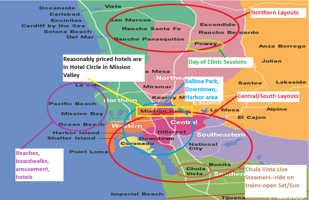
Many tourist attractions in San Diego are clustered in the BLUE circle including Old Town San Diego, downtown San Diego (Gas Lamp District), Balboa Park/Museums (including the Model Railroad Museum), the San Diego Zoo, the harbor (and Maritime Museum and USS Midway Aircraft Carrier Museum), and Petco Park (home of the San Diego Padres) and Hillcrest, the main LGBTQ+ neighborhood.
The YELLOW rectangle is Mission Valley and has a lot of reasonably-priced hotels (by San Diego standards). Also, in the Mission Valley area is Fashion Valley Outdoor Mall with many upscale stores.
The GREEN circle is where Andersen’s Nursery is located with an incredible large G-scale train display; admission is free.
The PURPLE circle indicates the beach areas.
The BROWN circle indicates where the Chula Vista Live Steamers are located; they’re open Saturday and Sunday and give free rides.
All the way at the bottom of the map is the US/Mexico border. You can walk across to Tijuana for shopping, dining, etc. You’ll need a passport or passport card to get back into the US. There usually is a long line to get back to the US. Take that into consideration if you plan to go.